

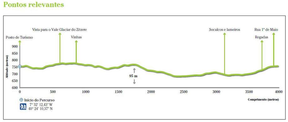
Starting point: near the Manteigas Tourist Office.
The Sun Route owes its name to the particular solar exposure. It’s a route with different and emblematic scenarios.
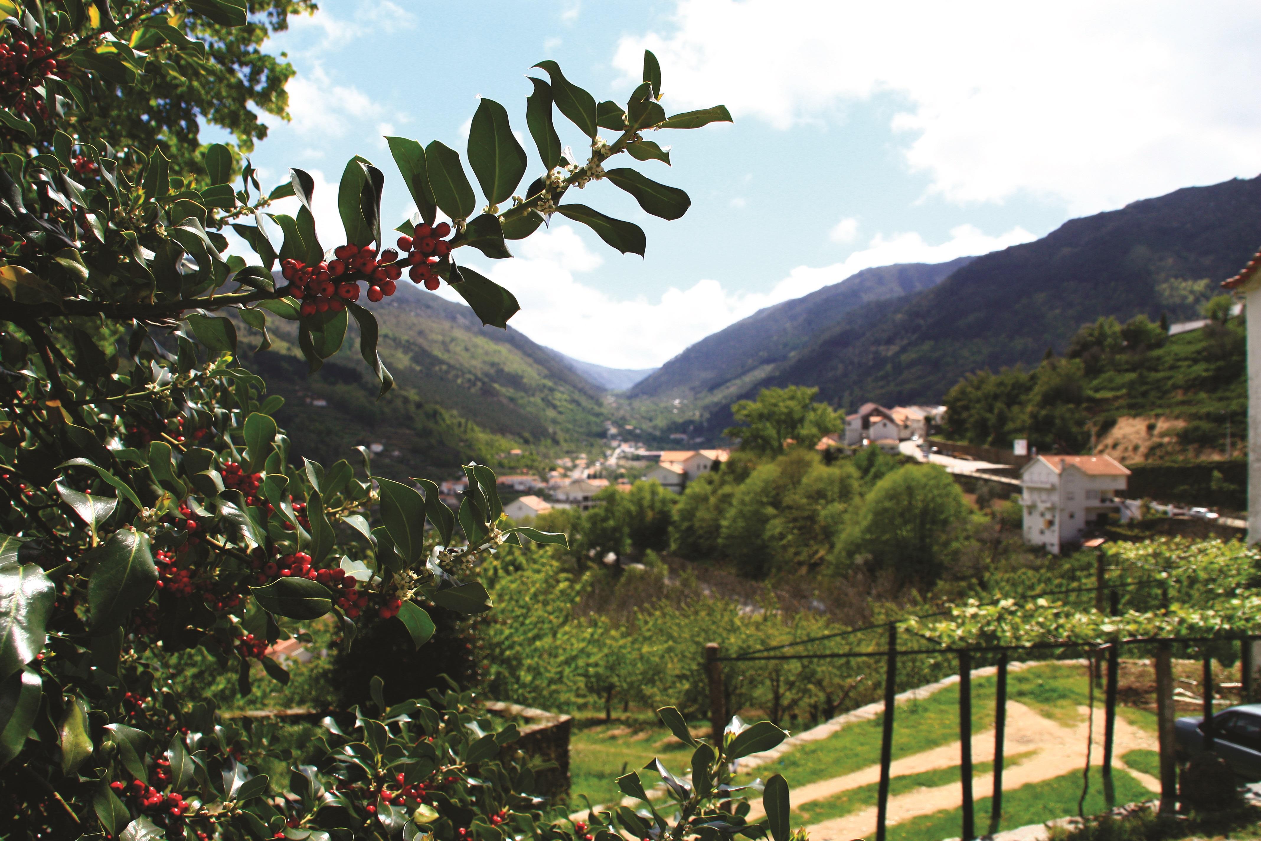
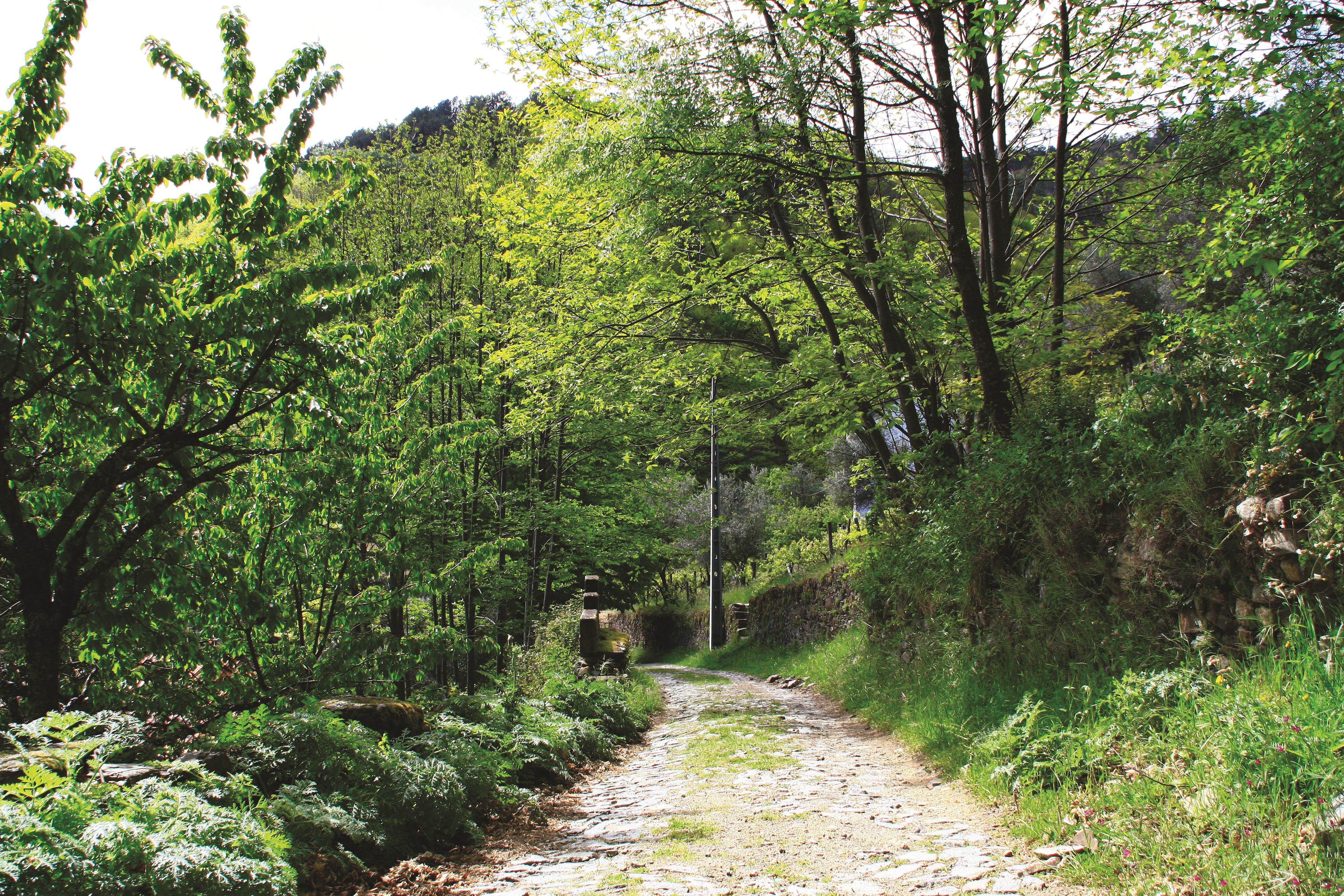
The walker may contemplate a landscape marked by a traditional agriculture influence, with vineyards, terraces, small horticulture, marshes and watercourses, be dazzle by the typical mountain houses (in granite or schist), paths and walls aromatized and ornamented by rosemary that particularize and embellish the landscape.
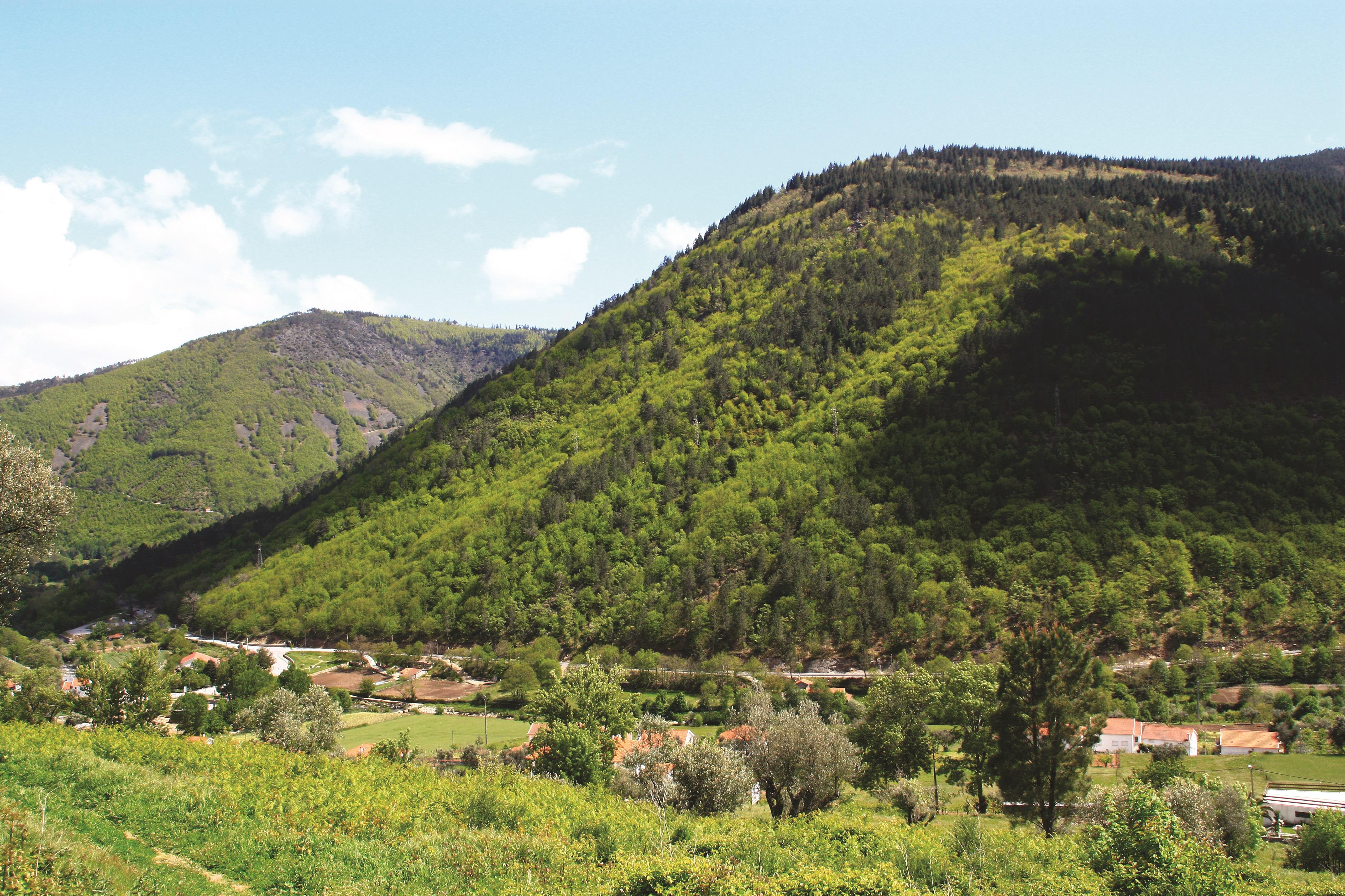
The highest altitude, the visual coverage shows a beautiful overview of the Zêzere Glaciar Valley and over composed water galleries, reflecting the intense green of the surrounding mountains, not to mention the curious mark that the gravel (“cascalheiras”) makes to the scenery.
The natural landscape is marked by the mixed forest, of conifers and broadleaf trees, which can be observed over most part of the route. In the derivation that connects Sameiro to Manteigas, the highlight is the Satan Head (“Cabeço de Satanás”) from where you can enjoy an overall and fascinating landscape of the woods that surround the Zêzere Valley.
Making the Sun Route is still an opportunity to observe the varied hues that are happening throughout the seasons of the year.
In what regards to flora, is to emphasize the oak, the Flax-leaved Daphne, the thyme, among others. It is also possible to observe specimens of Common Ash, English Oak, Alder, Poplar, Rowan, Gum Rockrose, Rosemary, etc.
From the faunal diversity, stand out the lesser horseshoe bat and the snub-nosed viper with a vulnerable conservation status. Are also present the Tawny Owl, the jay, the wild rabbit, the fox, the slow worm, the hedgehog, etc.
The trail allows to the walkers and nature lovers enjoy the silence, tranquillity, clean air and to have a better knowledge of the culture and tradition of Manteigas.
- Alertas
-
-
Trail PR15 Closed
1 January, 2016
-
- Route PR11MTG
-
- Name: Sun
- Type: Circular
- Coordinates of the beginning W: 7º32'12.43"W 40º24'10.37"N
- Height at the beginning: 756 m
- Minimum height: 684 m
- Maximum height: 779 m
- Advised direction: Clock hands
- Difficulty: Easy
- Extension: 4 km | 8,5 km (with leads)
- BTT: Yes
- Useful Documents